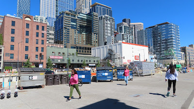
Musical homage
and offerings to a dead musician. Santa Ana, CA, November 2024. Photo by Myriam
Mahiques
1. Receptiveness
Psychology and sociology continuously refer to objects from a technological
perspective which is not related to individuals or the collective discourse.
In his book The System of Objects, sociologist Jean Baudrillard adds the
(social) imaginary as a a dimension linked to the object: “The object as
humble and receptive supporting actor, as a sort of psychological slave or
confidant- the object as directly experienced in traditional daily life and
illustrated throughout the history of Western art down to our own day. This
object was the reflection of a total order, bound up with a well-defined
conception of décor and perspective, substance and bound up with a well-defined
conception of décor and perspective, substance and form. According to this
conception, the form is an absolute dividing-line between inside and outside.
Form is a rigid container, and within it is substance. Beyond their practical
function, therefore, objects – and specifically objects of furniture- have a
primordial function as vessels, a function that belongs to the register of the
imaginary. This explains their psychological receptiveness.” (Baudrillard,
2020). In this sense, personal belongings are not just “things”.
Materiality is essentially physical. It shapes the objects, their
fabrication technique, the traces left by time. Materiality is apprehended
through our senses which differ according to the culture of communities. It is
a concept that expands to the idea of “social” and foremost to the relationship
between people and things.
Objects achieve a special strength with the feelings they are assigned
to. It could be just a simple pencil which was part of an event; for social
groups, it could be a procer’s relic. Offerings are left before statues and
memorials, then objects are a bridge between the alive and the dead.
The element of human perception, the understanding, the intangible part,
would be the “atmosphere”. Philosopher Gernot Böhme defines “atmosphere” as a
holistic, affective, and sensual quality of a space that mediates between the
objective environment and the subjective experience of individuals:
“I have introduced the concept of atmosphere (…) to designate that which mediates the objective qualities of an environment with the bodily-sensual states of a person in this environment; the environment in its entirety generates an atmosphere in which I, as a human, feel in one way or another. (…) I sense in which environment I am located (…). The concept of atmosphere is, according to this etymology, a concept concerning the in-between (Zwischen): between objective conditions and subjective states, between object and subject.” (Böhme, 2014)
China and
pottery remnants in Altadena after the wildfires. March 2025. Photo by Myriam
Mahiques
In an approach to the sensory expression, the previous paragraphs are
pertinent to the importance of our findings in Altadena. We have seen multiple
objects of daily life with different degrees of deterioration. Pieces of
folk-art stand out among cutlery, toys, décor. The Army Corps of Engineers’
contractors were working with heavy machinery, cleaning lots, and preparing the
preliminary excavation for soils remediation. There was no possibility of
selecting what would be of value for its repair, recycle or return to the
owners. The intangible and emotional aspects were not
included in the post-fire management protocol.
1.
Possible
exhibition of objects
Objects have their own biographies. David Howes (2023) writes about the
social force of objects: “It is not that this force needs to be
“revivified,” though, just acknowledged: “When you see an object reconnect with
its family, when they hold an old piece of beading or interact with a pipe, it
is not the object which is being reanimated but the relationship which is being
rekindled on both sides because of the materiality and sensory connection that
happens between them.”
There is also an extrapolation of these objects’ meaning. For example,
what was décor, and now is a ruin, could become a piece of exhibit in a museum.
An example of this, would be the piece of melted glass from the San Francisco
earthquake and fire (1906), donated by Grace Gratton Masterson to the Turtle
Bay’s Collection in Redding. The piece is exhibited online and at the museum. In
this context, the glass could be exposed due to its mineralogical conditions or
because now it is part of the fire collective memory.
2.
Brief
account from San Francisco history
|
|
Souvenirs hunters and
homeowners looking for personal possession after the earthquake and fire in
San Francisco, 1906. Photo from the National
Archives. |
Charles Morris (1906) reports the desperation of people trying to save
their household effects during the San Francisco earthquake and fire:
“In the awful scramble for safety the half-crazed survivors disregarded
everything but the thought of themselves and their property. In every
excavation and hole throughout the north beach householders buried household
effects, throwing them into ditches and covering the holes. Attempts were made
to mark the graves of the property so that it could be recovered after the
flames were appeased.” It is
interesting that he has used the word “graves” as if the objects had a life
once. Implicitly, Morris has assigned to the households a higher level of
importance.
3.
Objects
from Altadena
A shrine that
must be in good condition in the aftermath of Altadena wildfire. March 2025.
Photo by Myriam Mahiques
Local art
among the ruins of Altadena, March 2025. Photo by Myriam Mahiques
The
Installation “Recycled Words” at the Manitoba Museum was the work of KANVA, a
group of young architects in Montreal. Curator Maureen Matthews proposed words
on the chairs to provoke thoughts. 2015.
The installation shown above reminds us of the single chair “exposed” among the ruins of the wildfire in Altadena. This chair might have been on a porch. We see it as a gloomy sculpture that carries a memory of the past life in this burnt house.
A single chair on the new lawn after the rain. Altadena, March 2025. Photo by Myriam Mahiques.
In Los Angeles wildfires of 2025, lots of individuals grappled with what they wanted to take with them; the difficult selection lasted just a few minutes. From Gillan Telling’s article “What They Grabbed in the L.A. Fires and Why: Tender Stories from Those Who Left Almost Everything Behind (January 12th, 2025), we cite Sloan Pechia’s story who, apart from a letter from her late grandmother, she carried a poem from a book: “I also took the poem “Imagine a Woman,” which was sent to me in a letter from my mom during my freshman year of college. Reading it and reminding myself that I’m strong is why I thought to take it during these incredibly trying times.”
|
|
Valuable personal items that Sloan Pechia
took with her during the wildfire evacuation. Photos by Sloan Pechia. |
This is not that everyone has the chance to survive a catastrophe.
Regarding this, we recommend reading the work of the Lucy Easthope, a British
expert and adviser on emergency planning and disaster recovery. A great part of the management
post-catastrophe is the removal of personal effects that may be returned to a
bereaved family. “The item may have little or no monetary value but may mean
everything to a grieving family; or to a survivor struggling to make sense of
terrible events.” (Easthope, 2019). As we have seen in the Los Angeles
wildfires, without an “ethic of care” from all responders, the personal effects
are indiscriminately removed to landfill or even incinerated.
“(…) response plans should
therefore aim to prioritize personal effects with a principal aim to identify,
locate and restore personal property in a timely and accurate manner that
allows survivors and bereaved to make as many of their own choices as
possible.” (Easthope, 2019).
It is recommended that strategies for devolution and restoration be devised to enable survivors to exercise decision-making authority over their valued possessions, which hold intrinsic and emotional significance.
BIBLIOGRAPHY
Baudrillard, Jean. The System of Objects. London, 2020.
Bohme, Gernot. The
theory of atmospheres and its applications. Translated by A. Chr.
Engels-Schwarzpaul. In Interstices Journal of Architecture and Related Arts.
Issue 15. 2014-03-18
Easthope, Lucy. The meaning of “things”. The evolution of an ethic of care in the return of personal effects after disaster 2001-2019. P. 122-128. In Bereavement Journal.org. 2019.
Howes, David. Sensorial Investigations. A history of the senses in anthropology, psychology, and law. The Pennsylvania State University Press. 2023.
Morris, Charles. The San Francisco Calamity by
Earthquake and Fire. Told by Eye Witnesses. Secaucus, N.J.: Citadel Press, ca.
1906.
Telling, Gillian. “What They Grabbed in the L.A. Fires and Why: Tender Stories from Those Who Left Almost Everything Behind”. People.com. January 12th, 2025.
NOTE: this post is also published on AIA Los Angeles blog.


